Midkemia: The Chronicles of Pug
The original Photoshop source map for Triagia and how it ended up for the book.
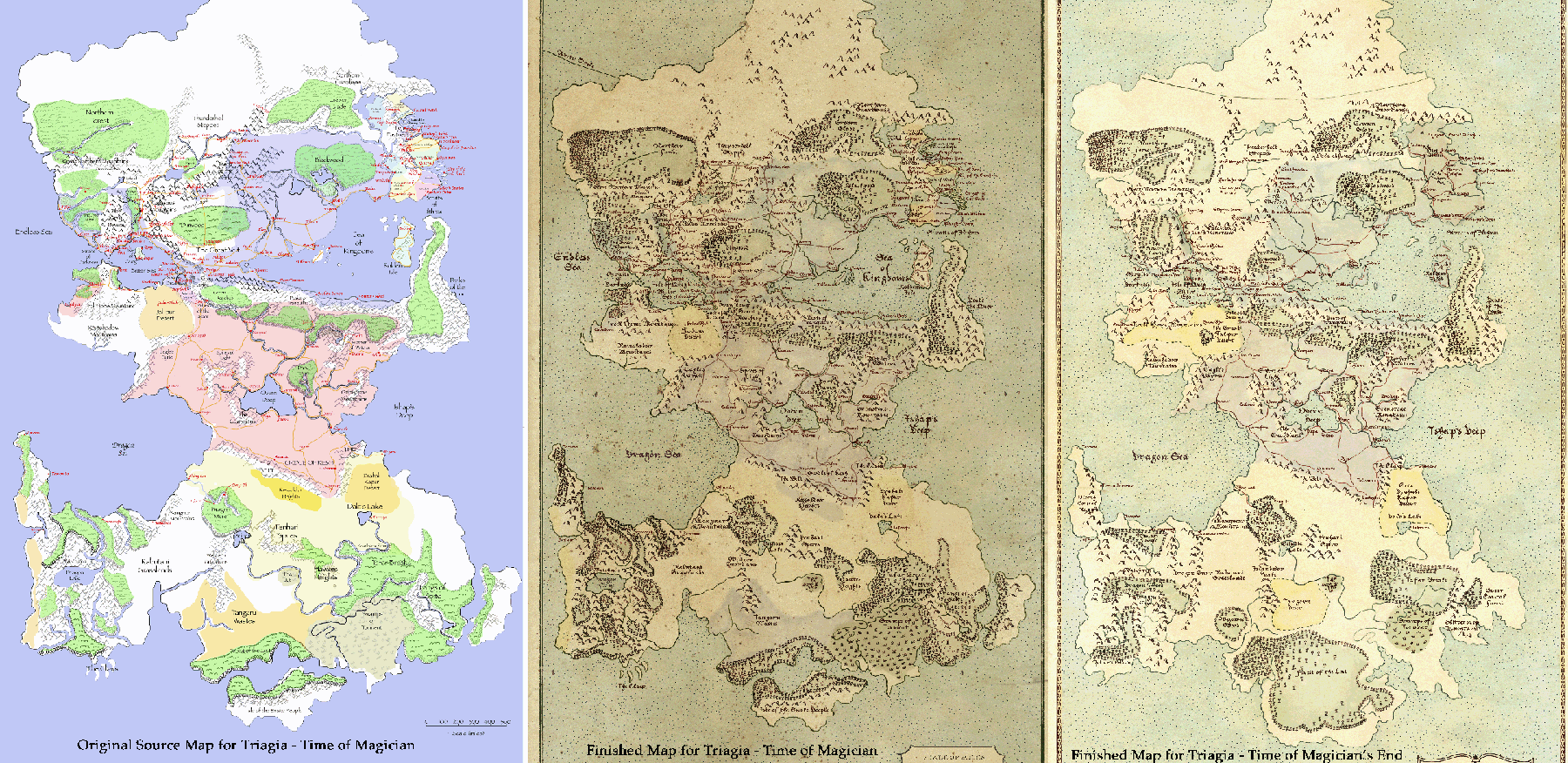
The original working map was prepared in multiple layers in Photoshop with each terrain type in a separate layer as well as titles for towns and cities. Roads and geo-political boundaries were added as well. These source maps were then provided to Minalima to be turned into the finished, more authentic looking, maps seen in the final book.
Note that there are three map images on this page and it may require you to scroll to the right to see the final map at the time of Magician's End.
I thought it worth mentioning here that at least one reviewer has commented on the 'typos' in names between maps and text. While there certainly may be some typos, in the majority of cases differences in names across maps is intentional and represents the different spellings of place names as understood by different cartographers in different places on the planet and different time periods. For any 'real' typos - our apologies.